
What is proposed for our area?
A starting point for understanding the Blackthorn application, its location and the plans submitted to Galway County Council.
The facts at a glance
- Applicant
- Blackthorn Solar Farm LimitedPlanning Statement · document 2746201 ↗
- Application
- 26/61567 · Galway County CouncilOfficial application documents ↗
- Overall development area
- Approximately 93 hectaresOfficial application documents ↗
- Layout
- Two land parcels near Lackagh and KnockdoeSubmitted plans and drawings ↗
Where is the proposal?
See the two proposed land parcels near Lackagh and Knockdoe, covering approximately 93 hectares in total. The northern parcel adjoins the local walking trail. Lackagh village lies to the northeast. Select the map to open the full-size Council drawing.
Open the original Council drawing (PDF)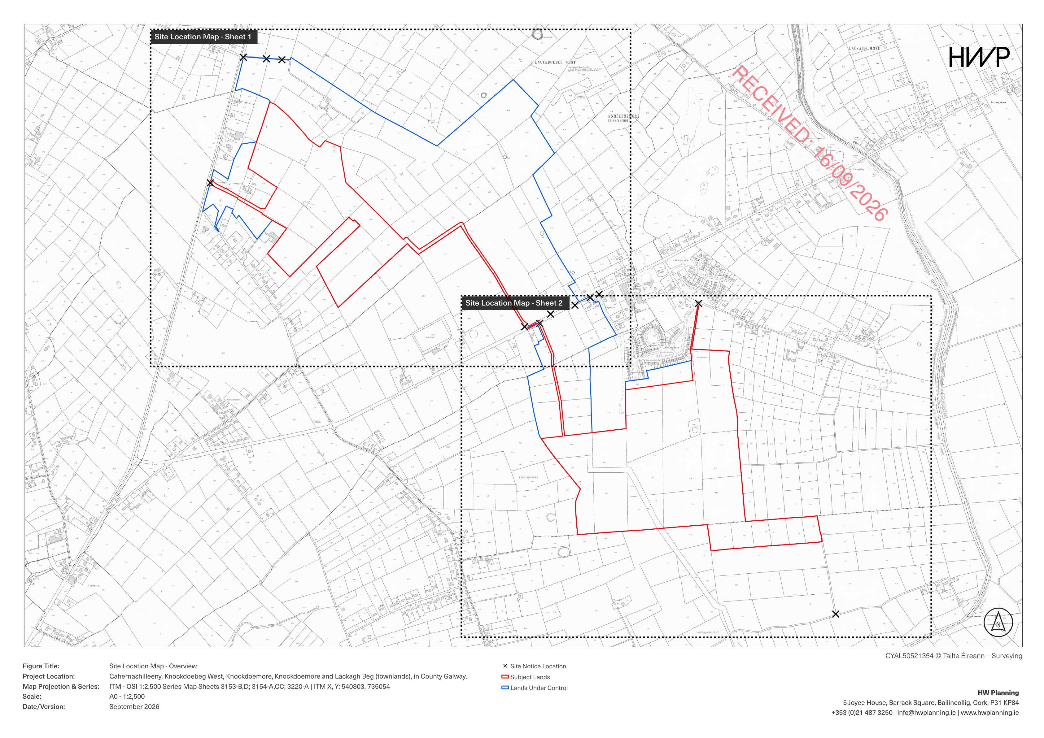
A closer view of the applicant’s two parcels. Labels have been added to help you find your bearings; the red boundaries are from the Council drawing. Select the map to see the complete original sheet.
The walking trail runs beside the northern parcel. See the published walking-trail map (PDF).
Red outline: subject lands. Blue outline: lands under control. Black crosses: site notice locations. Dotted rectangles: the areas covered by the two detailed sheets.
The application documents
The Council’s official file contains the applicant’s Planning Statement, drawings and supporting reports.
View the complete application ↗Planning status
At our last check, Galway County Council listed this as a NEW APPLICATION. Check the live record before sending your submission.
Check the latest official record ↗